
 01473 805575
More On The Online OS Maps Facility
The OS Maps web site has recently migrated from their original location at https://osmaps.ordnancesurvey.co.uk to a new site at https://explore.osmaps.com. At the moment, some of the Case walks pages refer to the original location and some to the new but all the links still work.
If you are a premium subscriber to the OS Maps online service, more options are available to you but even casual users (ie. those without an OS Maps user login) can view maps on screen. As a casual user you will be limited to the use of so-called Standard maps whereas subscribers can access the content of OS Landranger and Explorer maps. However the Standard maps should be sufficient for these walks, especially if you use them in combination with the other material provided on this web site.
To access the relevant OS map, follow the link at the top of each of our walk pages. If you have the OS Maps app installed on your device, the app will open with the route displayed. If you don’t have the app, your browser will open a new tab and display the route there. If you’re viewing the route in your browser, click the option to Add key waypoint labels to route. If you are interested in inspecting the route in more detail, click the Toggle full screen button on the right hand side of the screen (the one with the diagonal arrows) and click on the Zoom in button above it (the one with the plus sign). You can then click and drag the map around to focus on particular parts. Fig 1 illustrates a browser based display (for Walk 1) with the Standard map type selected. Click the image for a larger view.
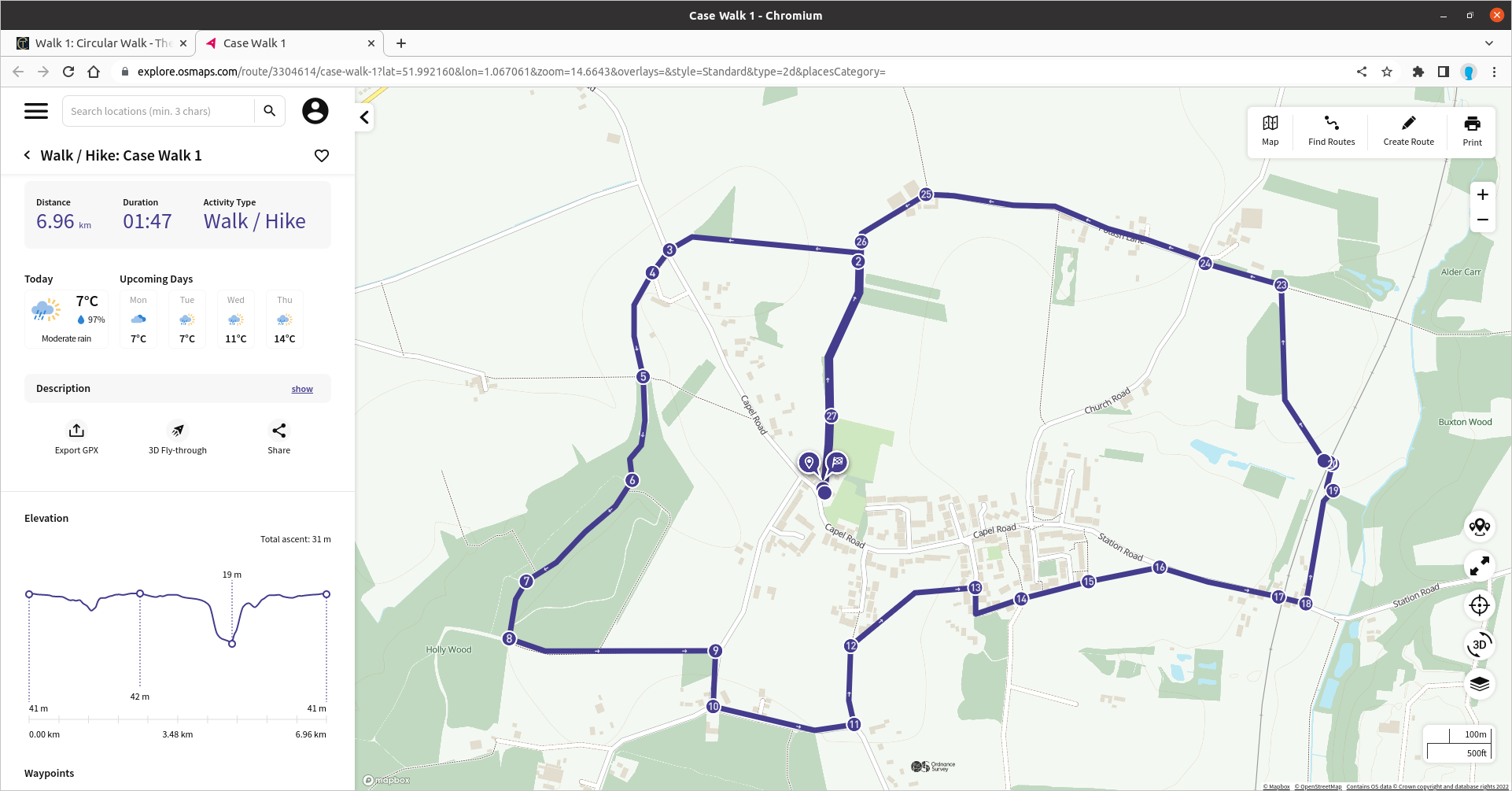
Fig 1 – OS Maps route in a browser
If you are a premium subscriber to the OS Maps service and have their app installed on your mobile device, we recommend enabling Show Key Waypoints in the Route Options. The display will then look like Fig 2 which also shows the route for Walk 1 but with a map type of Premium Topo selected – that’s equivalent to the content of OS Landranger (1:50,000) or Explorer (1:25,000) maps depending on the scale selected. You can then choose to follow the route and the app will then show your location in relation to the given route, indicate the direction your phone is pointing and re-position the map automatically as you move. Tap any of the waypoint symbols on the route (shown as blank circles) and the specific waypoint number will be revealed plus instructions associated with that waypoint. That’s illustrated by Fig 3 where the user has zoomed in to show more detail and their location is indicated by the red arrowhead just below the waypoint 2 marker and in Fig 4 when they’re on the return path.
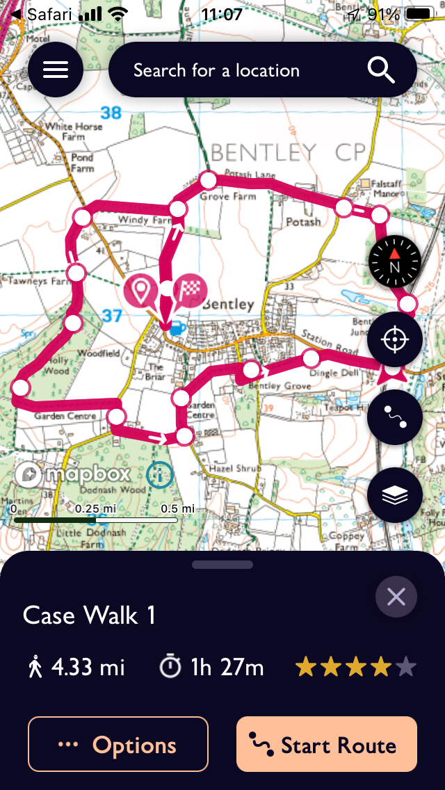
Fig 2 – OS Maps route in the app on a phone
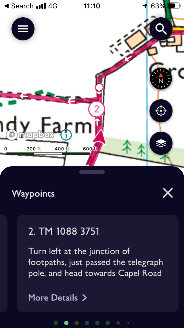
Fig 3 – Approaching waypoint 2 in the OS Maps app on a phone
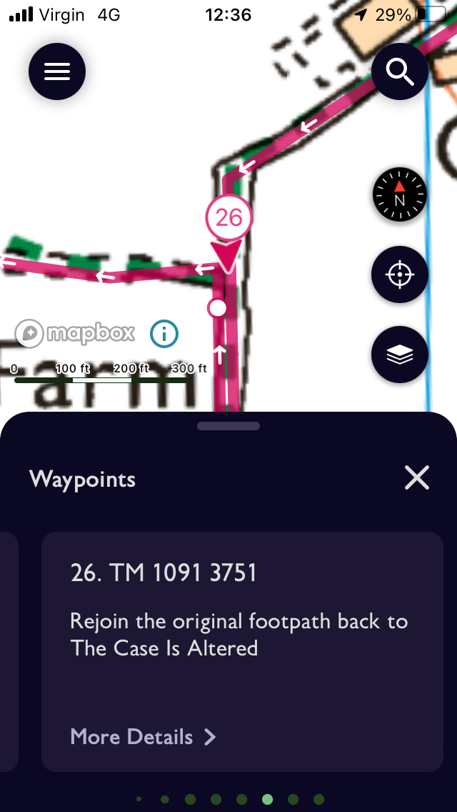
Fig 4 – At waypoint 26 in the OS Maps app on a phone
Remember you can switch between the OS maps display and the Case web site as you go to view the full walk instructions and waypoint photos.
Return to Walks From The Case