
 01473 805575
Walk 2: Capel St Mary
Walk reviewed: 5/8/19
Instructions last updated: 12/8/19
 Case Walk 2: OS Maps online
![]() Walk 2 route map (2 pages)
Walk 2 route map (2 pages)![]() Walk 2 instructions (text only; 2 pages)
Walk 2 instructions (text only; 2 pages)![]() Walk 2 photos (larger size; 3 pages)
Walk 2 photos (larger size; 3 pages)![]() This page (compact combined text & photos; 2 pages)
This page (compact combined text & photos; 2 pages)
This walk is approximately 6 miles and runs across fields to reach the underpass to Capel St Mary at the A12. It then skirts around Capel St Mary and returns to the Case is Altered via the same footpath from the underpass. As the walk is essentially a loop around Capel, you could cut it short to return to Bentley at any stage. The route is a mixture of off-road and on-road sections and some of the sections can be quite muddy and some run through long grass.
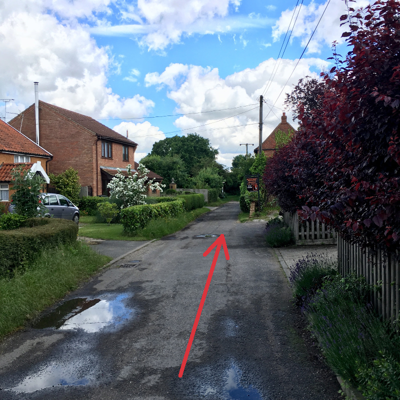
Waypoint 1
Waypoint 2
Waypoint 3
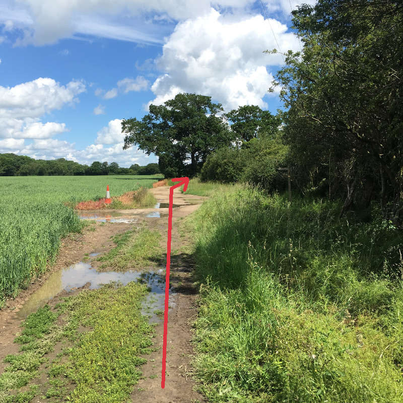
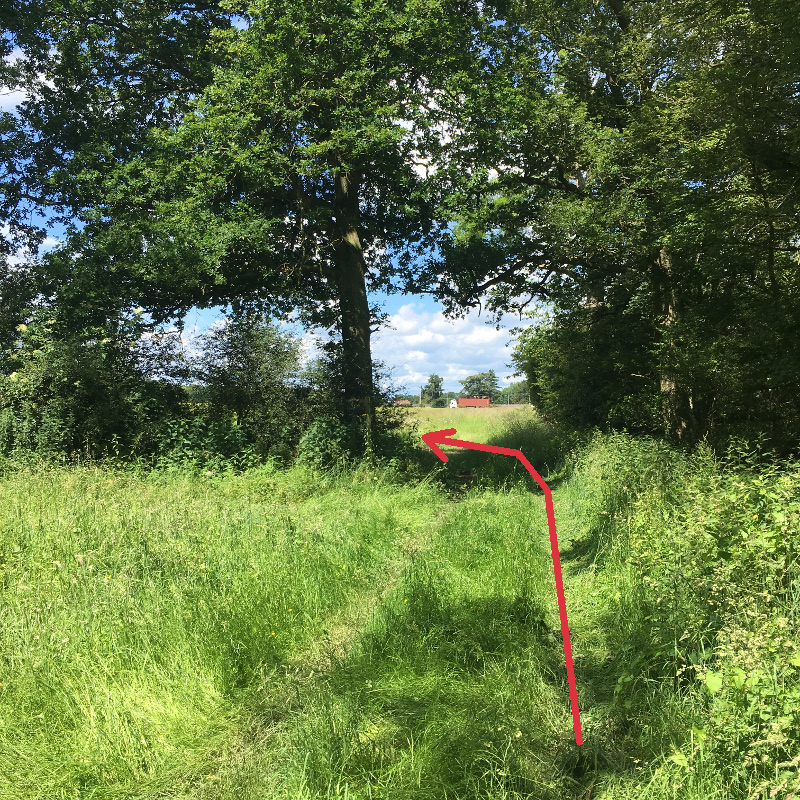
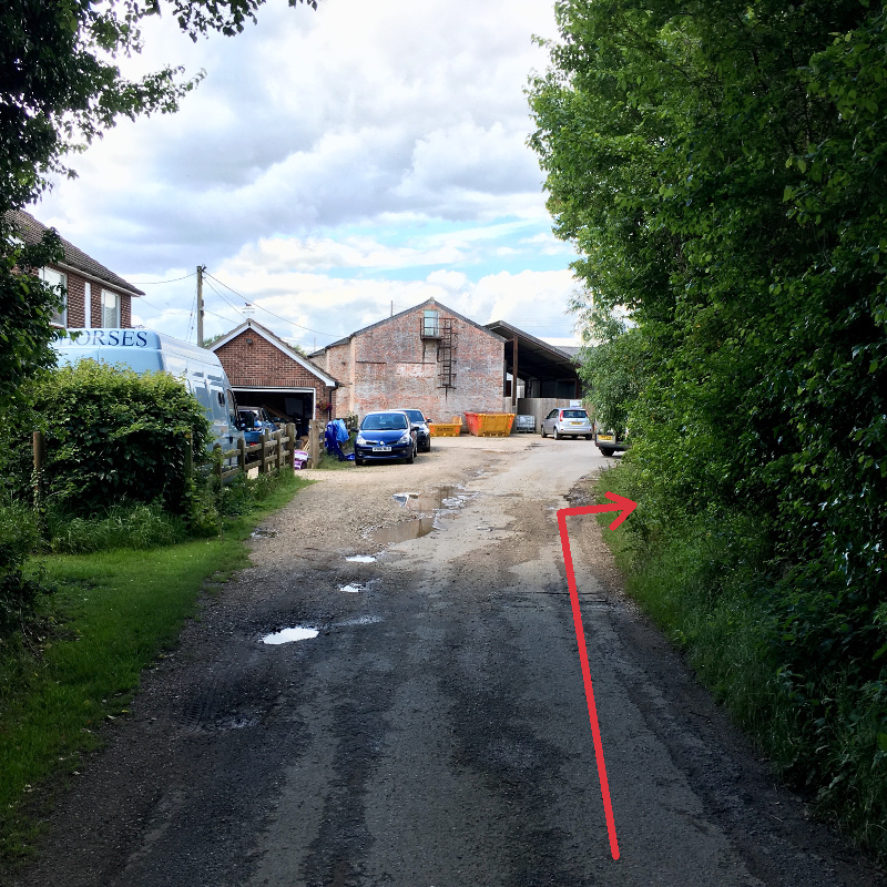
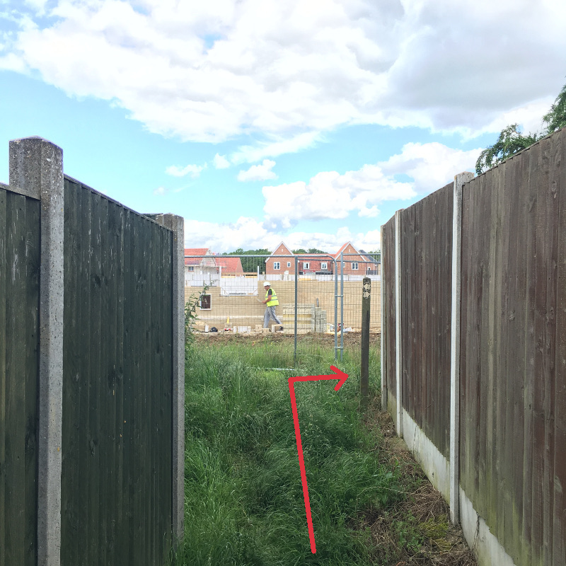
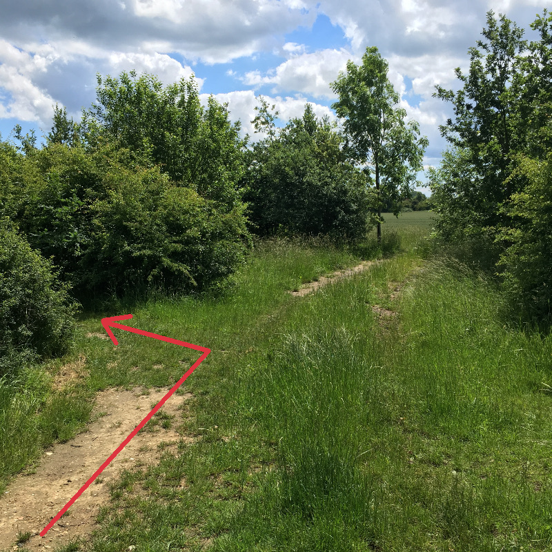
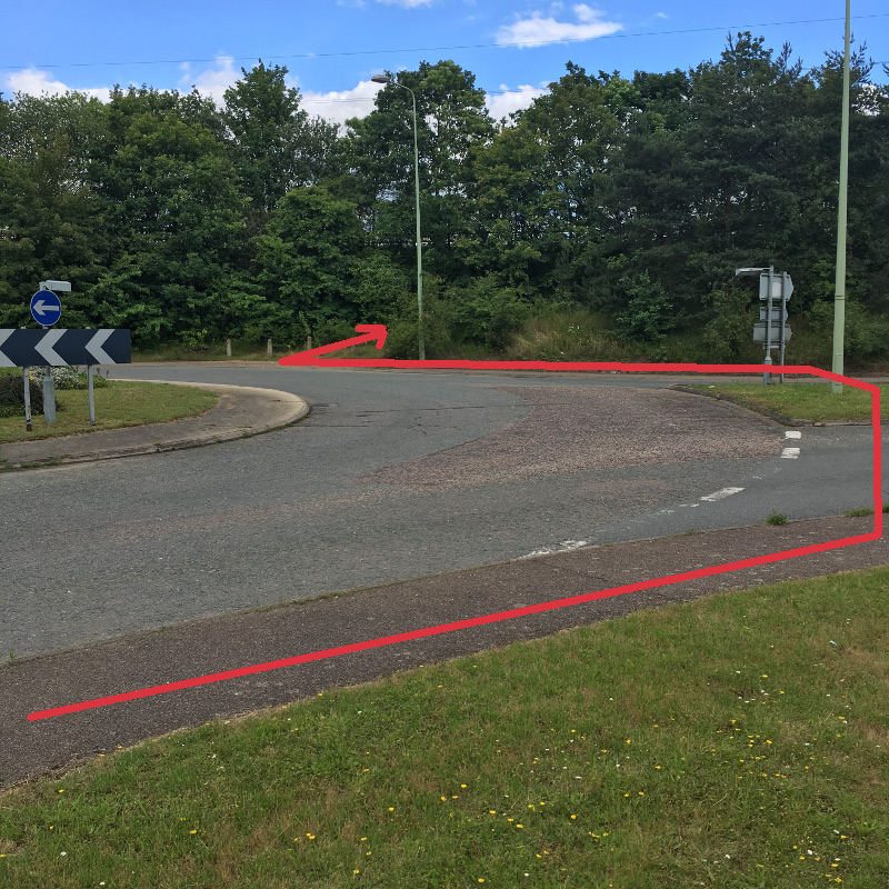
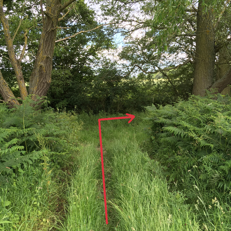
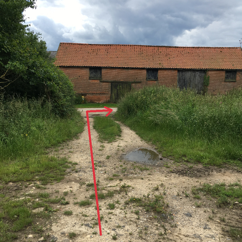
From the Case is Altered walk Northwards up Case Lane (WP1), past the entrance to the playing field and continue on to the footpath and then out into open country. The path soon becomes a track, and across the first field when you reach a footpath junction (WP2), carry straight on ignoring the connecting track out to the Capel Road. The path then bends round to the right and crosses a farmyard. Turn left when you reach the old barn, labelled Grove Farm (WP3), to head North again onto another public footpath. Note: This section (upto WP4) can be quite muddy. Continue through wooded areas on the track known as Pond Hall Lane ignoring turnings to the left and right marked private. Just before you reach a wooden footbridge over a ditch, turn left (WP4) onto a signposted footpath between two ash trees heading West towards the A12. The footpath runs alongside an open drainage ditch then enters more woodland. As it exits the wooded area (WP5), bear half left to cross an open field. When you reach the far side of the cultivated field carry straight on across a rough area (WP6) of long grass and continue to follow the track along the edge of the field which will eventually lead down a slope to a roundabout on the A12 sliproad at junction 32A (WP7).
Take care at this point – you need to cross the road and keep to the left hand pavement under the underpass but it’s best to turn left at the roundabout and walk to the crossing point marked by a dropped kerb at the bottom of the slip road which leads up to join the A12 Southbound.
Waypoint 4
View Approaching Waypoint 5
View Beyond Waypoint 5
Waypoint 6
Waypoint 7
Waypoint 8
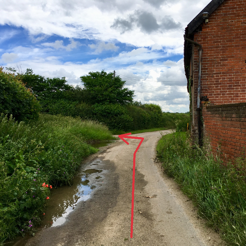
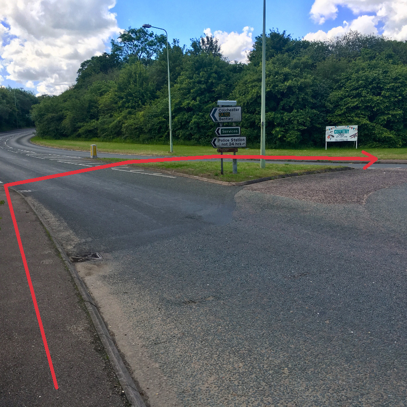
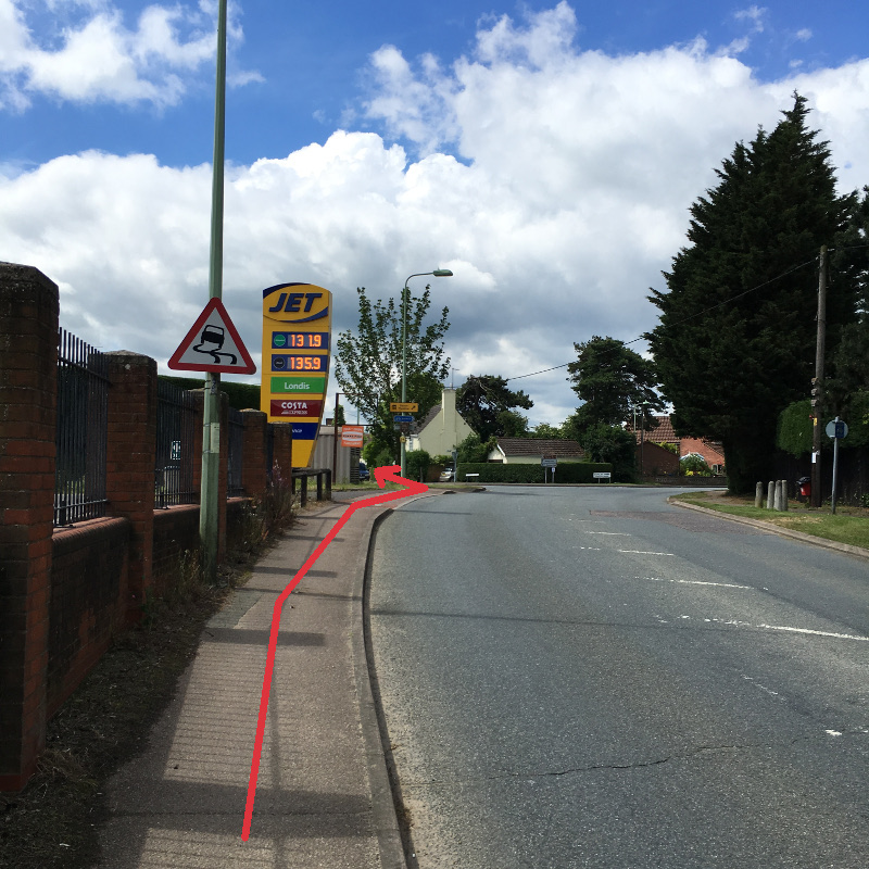
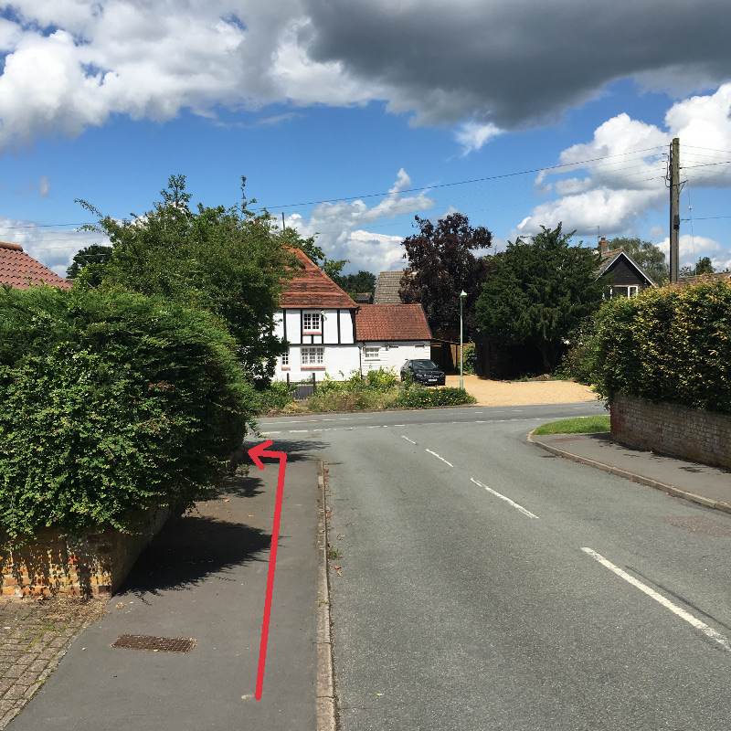
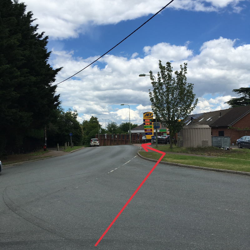
After the underpass, bear left after the Jet garage and walk along London Road (WP8) with the White Horse pub on your right. Walk to the end of London Road then bear right just before you reach the A12 (WP9) following the direction indicated by the road sign that says “Capel Grove only”. Keep to the right hand pavement until vegetation makes that impossible then follow the road as it bends sharp right (WP10) leaving a residual footpath running ahead alongside the busy A12. This route is labelled as a private road but it is also a public right of way. Follow the road (Red Lane) as it bends left and right but take care as there is no pavement and visibility is limited.

Waypoint 9
Waypoint 10
Waypoint 11
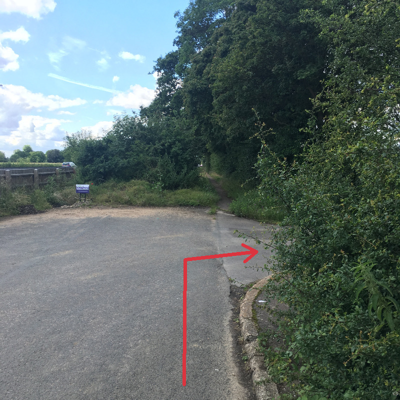
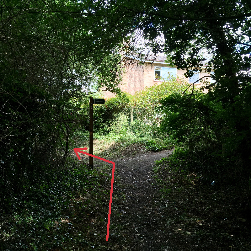
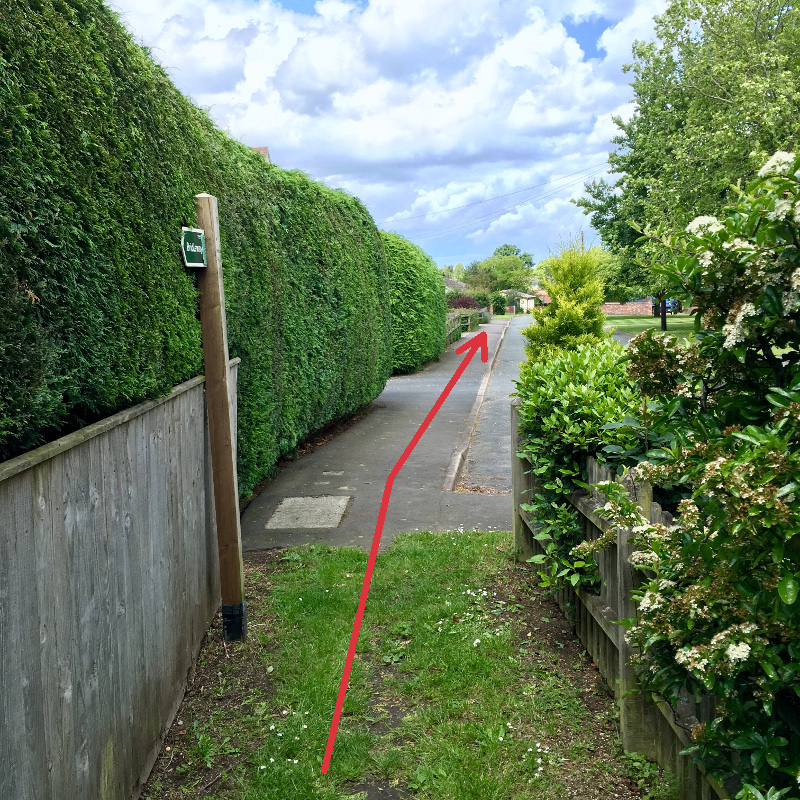
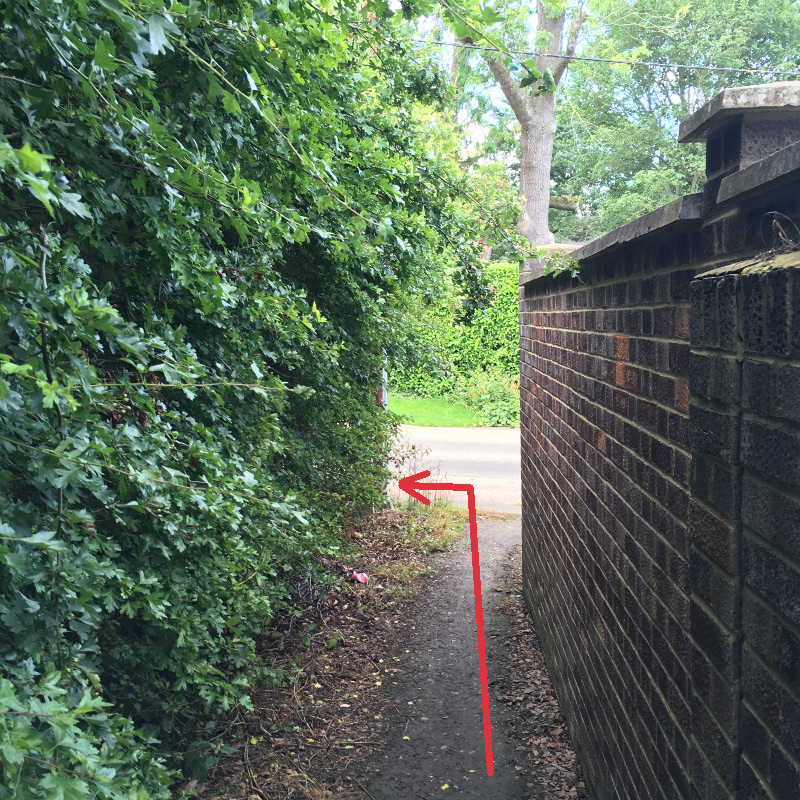
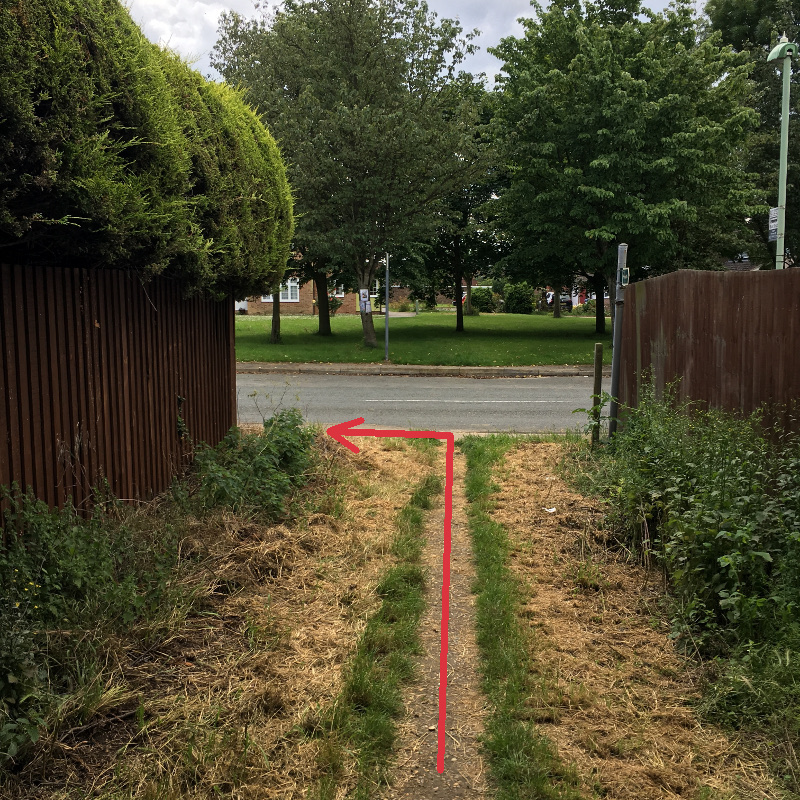
As you approach the start of buildings at Capel Grove look out for the end of the field on the left then look for a gap in the hedge on the right hand side. This marks the entrance to a footpath that is virtually hidden from view at first glance (WP11). Turn right onto this footpath and then bear left at the signpost (WP12) to follow the onward route marked Bridleway. Follow this sheltered path until you emerge into an area of residential housing (WP13) continue straight ahead on the pavement (along Cedar’s Lane) and turn left when you reach the main road, The Street (WP14).
Waypoint 12
Waypoint 13
Waypoint 14
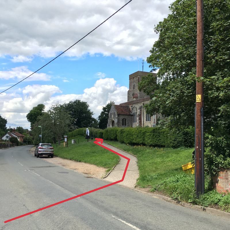
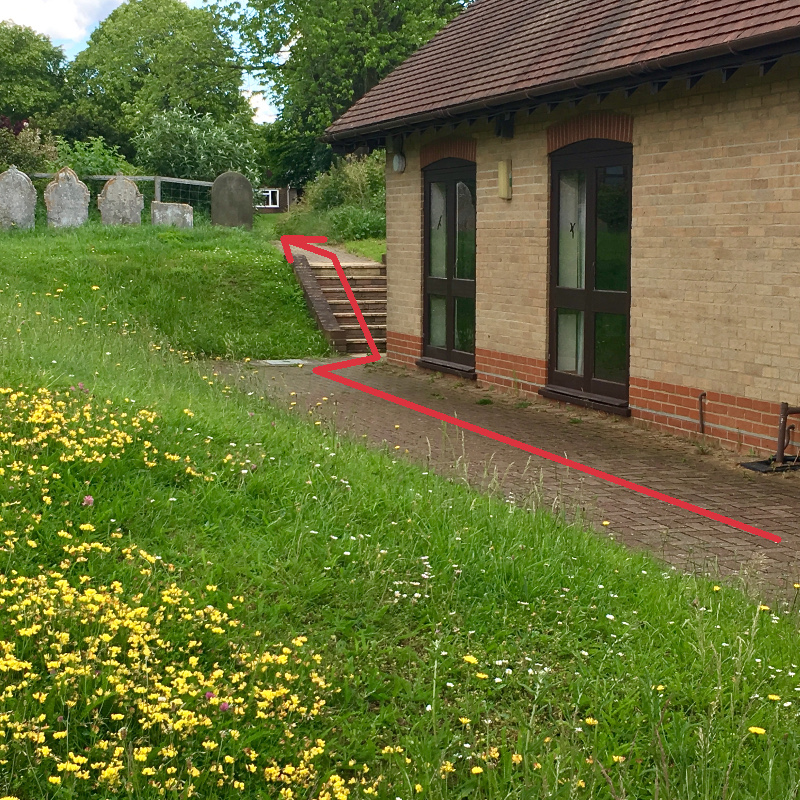
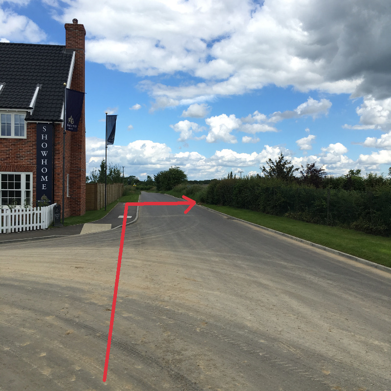
Just before you reach the Pound Lane turning on the left, cross the road and take the path on the right towards the main entrance to St Mary’s church (WP15). Follow the path past the main church entrance and skirt around the building to the left, pass the new church hall at the rear and exit the church yard via the short flight of steps (WP16). Then continue on the path straight ahead. Cross the road and continue on the footpath opposite (as indicated by the yellow, post mounted, footpath marker). Continue in the same direction until you reach the new Saxon Meadows housing development, then turn right onto the footpath that crosses in front of you (WP17). Follow this path and eventually emerge onto Days Road and turn left (WP18).
Waypoint 15
Waypoint 16
Waypoint 17
Waypoint 18
Waypoint 19
Waypoint 20
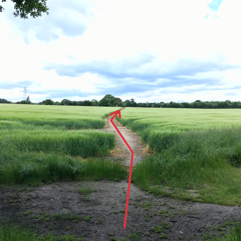
Walk North up Days Road and take the signposted footpath on the right (WP19) just after the main entrance to Saxon Meadows on the left. Take care, the footpath upto WP22 can be muddy and slippery. At the intersection of several footpaths, keep right where a path leads forward on both left and right sides of the hedge in front of you (WP20). Then turn to the right and walk along the path to the left of a wire fence edging a field.
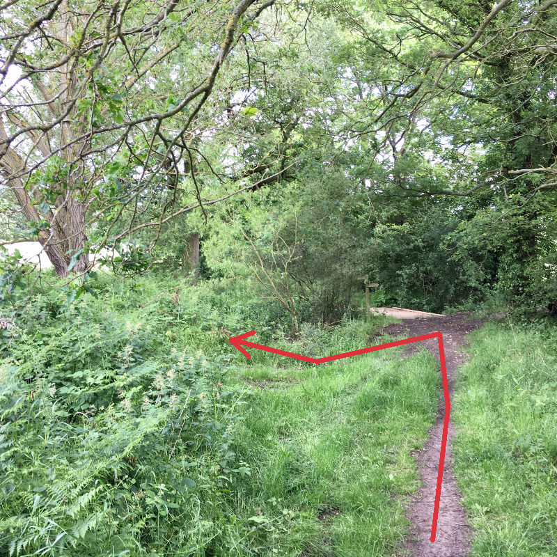
Waypoint 21
Waypoint 22
Waypoint 23
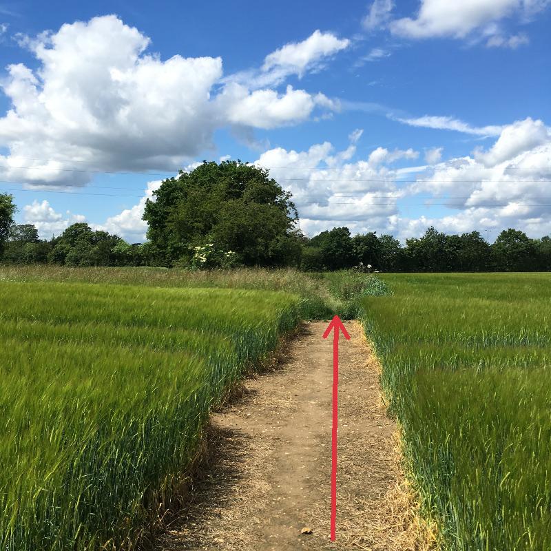
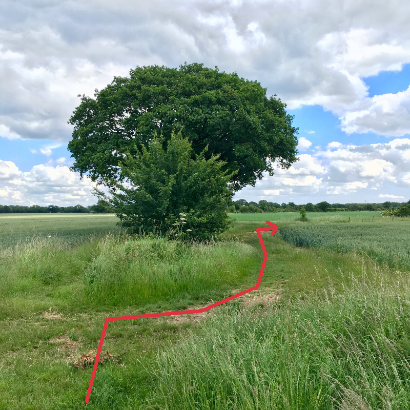
At the next footpath junction, take the path to the left (WP21) which then arcs round to the right, then follow it across the open field and continue onto the sheltered path. Eventually emerge at Thorney Road (with a bus stop on your right) and turn left (WP22). Follow Thorney Road as it gradually arcs round to the right.
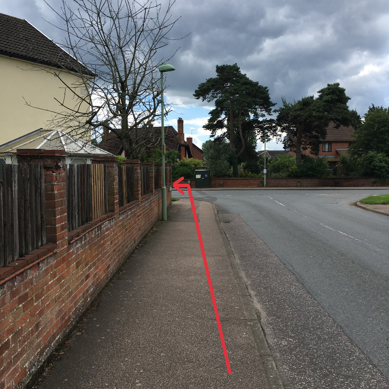
When you reach the main road (The Street), take care and cross the road at this point (visibility is very poor as you approach the bend later), turn left (WP23) and continue towards the Jet garage using the right hand pavement.
Continue under the underpass (WP24) and then re-trace your steps (via WP25, WP26, & WP27) back towards Case Lane and the start of the walk at the Case is Altered.
Waypoint 24
Waypoint 25
Waypoint 26
Waypoint 27
Return to Walks From The Case
News Headlines
- Quiz Night: 27th April 2024
- Our New Charity of the Year: April 2024
- Wanted: Volunteers for the Case
- Share Offer: Ongoing
Events Calendar
Events in April 2024
| Monday | Tuesday | Wednesday | Thursday | Friday | Saturday | Sunday |
|---|---|---|---|---|---|---|
12:00 pm: Easter Monday
1st April 2024
12:00 pm to3:00 pm The pub will be open for lunchtime drinks, 12 - 3pm, on this Bank Holiday Monday.
|
2nd April 2024
|
3rd April 2024
|
4th April 2024
|
10:30 am: Coffee Morning
5th April 2024
10:30 am to12:00 pm Regular meet up for tea/coffee and chat.
|
6th April 2024
|
7th April 2024
|
8th April 2024
|
9th April 2024
|
10th April 2024
|
8:00 pm: Open Mic Night
11th April 2024
Open Mic with music from 8pm. Bar open from 6pm. All performers and listeners welcome! |
10:30 am: Coffee Morning
12th April 2024
10:30 am to12:00 pm Regular meet up for tea/coffee and chat.
|
5:00 pm: Dolly's Pizzas
13th April 2024
5:00 pm to8:00 pm Dolly will be with us again on Saturday 13th April between 5pm and 8pm. For pre-orders please ring 07856 070123. The pub will be open from 5pm so eat in or take away. Families are welcome.
|
14th April 2024
|
15th April 2024
|
16th April 2024
|
1:00 pm: 10th Anniversary
17th April 2024
 On Wednesday 17th April 2024 we will be celebrating 10 years since we first opened our doors as a community owned pub and started trading as Bentley Community Pub Limited. In fact the Case was the first co-operative pub in Suffolk. We think Bentley should be proud of the Case's important status amongst community and…
|
18th April 2024
|
10:30 am: Coffee Morning
19th April 2024
10:30 am to12:00 pm Regular meet up for tea/coffee and chat.
|
7:00 pm: Live Music: Robbie Gladwell
20th April 2024
7:00 pm to11:00 pm On Saturday 20th April, the very popular Robbie Gladwell and his band will be returning to entertain us. The band will start around 8.30pm. During the evening a BBQ will be available from around 7pm. We will be staying open a little longer than usual and last orders will be at 10:45pm.
|
21st April 2024
|
22nd April 2024
|
23rd April 2024
|
24th April 2024
|
7:30 pm: Book Group |
10:30 am: Coffee Morning
26th April 2024
10:30 am to12:00 pm Regular meet up for tea/coffee and chat.
|
8:00 pm: Quiz Night
27th April 2024
The quiz will start at 8pm. Teams can be up to 6 members. Entry is £2 per person. Bar opens 6pm.
|
28th April 2024
|
29th April 2024
|
30th April 2024
|
1st May 2024
|
2nd May 2024
|
10:30 am: Coffee Morning4:00 pm: Beer Festival
3rd May 2024
4:00 pm to11:00 pm We will be holding a beer festival over the May Day Bank Holiday weekend, on 3, 4, 5 and 6 May. We will be selling over 20 different real ales from across East Anglia and surrounding areas. While the beer festival is running, savoury foods and bar snacks will be available to buy in the…
|
12:00 pm: Beer Festival
4th May 2024
12:00 pm to11:00 pm We will be holding a beer festival over the May Day Bank Holiday weekend, on 3, 4, 5 and 6 May. We will be selling over 20 different real ales from across East Anglia and surrounding areas. While the beer festival is running, savoury foods and bar snacks will be available to buy in the…
4:00 pm: Wokn'Roll
4th May 2024
4:00 pm to8:00 pm On the Saturday evening, 4th May, a new street food vendor, Wokn’Roll will be with us. They will be selling their tasty, authentic Chinese noodle cuisine from 4pm to 8pm.
|
12:00 pm: Beer Festival
5th May 2024
12:00 pm to10:00 pm We will be holding a beer festival over the May Day Bank Holiday weekend, on 3, 4, 5 and 6 May. We will be selling over 20 different real ales from across East Anglia and surrounding areas. While the beer festival is running, savoury foods and bar snacks will be available to buy in the…
|